- Addiewell No.1 pit
- Addiewell No.1 mine
- Addiewell No.2 pit
- Addiewell No.2 mine
- Addiewell No.3 pit
- Addiewell No.3 mine
- Addiewell No.4 pit
- Addiewell No.5 pit
- Addiewell No.6 pit
- Addiewell No.18 mine
- Albyn mine
- Alderstone No.43 mine
- Baads No.9 pit
- Baads No.15 pit
- Baads No.17 mine
- Baads No.22 pit
- Baads No.23 pit
- Baads No.42 mine
- Boghall No.1 pit
- Boghall No.2 coal pit
- Boghall No.3 pit
- Boghall No.4 pit
- Boghall "Raeburn" mine
- Breichdykes pits
- Breich No. 1 & 2 pits
- Burngrange No. 1 & 2 pits
- Burngrange No. 39 mine
- Burntisland No.1 mine
- Burntisland No.2 mine
- Burntisland No.3 mine
- Burntisland No.4 mine
- Carledubs mine
- Champfleurie mine
- Cobbinshaw No.1 & 2 mines
- Cobbinshaw No.5 mine
- Cobbinshaw South No. 1 pit
- Cobbinshaw South No.28 mine
- Cobbinshaw South No.3 mine
- Cobbinshaw (West Calder Oil) pit
- Cousland No.1 mine
- Cousland No.2 mine
- Crossgreen No.1, 2, & 3 mines
- Cuthill No.24 coal mine
- Dalmeny No.1 pit
- Dalmeny No.2 pit
- Dalmeny No.3 pit
- Dalmeny Railway No.1 & 2 mines
- Deans (Caputhall) mine
- Deans No.1 mine
- Deans No.2 mine
- Deans No.3 mine
- Deans No.3 mine & quarry (W.L.O.C.)
- Deans No.4 mine
- Deans No.4 pit
- Deans No.5 mine
- Deans No.6 mine
- Deans No.7 mine
- Drumcrosshall No1. & No.2 mines
- Drumshoreland Muir pit
- Duddingston No. 1 & 2 mines
- Duddingston No.3 mine & quarry
- Dunnet or Sandholes mine
- Dunnet's mine, East Hermand
- Easter Breich coal mine
- Easter Breich No.1 & 2 pits
- Fivestanks mine
- Fivestanks; unidentified mine
- Forkneuk No.1 & 2 pits
- Forkneuk No.38 mine
- Forkneuk No.9 & 10 pits
- Fraser pit
- Gavieside No.1 pit
- Gavieside No.2 pit
- Gavieside No.3 pit
- Gavieside No.40 mine
- Grange No.1 & 2 pits
- Grange No.3 pit
- Greendykes North mine
- Greendykes South mine
- Greenfield No.1 pit
- Greenfield No.3 mine
- Hartwood mine & coal pit
- Hayscraigs mines and quarries
- Hermand mine
- Hermand (Murray's pool) mine
- Hermand No.5 pit
- Hermand No.6 mine
- Hillend coal pit
- Holmes mine
- Hopetoun No.35 pit
- Hopetoun No.4 mine
- Hopetoun No.1 pit
- Hopetoun No.2 pit
- Hopetoun No.3 mine
- Hopetoun No.41 (Fawnspark) mine
- Hopetoun No.44 mine
- Hopetoun No.5 pit
- Hopetoun No.6 (Glendevon) mines
- Hut mines and quarry
- Ingliston No.33 pit
- Ingliston No.36 & 37 pits
- Lawhead No.1 mine
- Limefield No.32 mine
- Livingston quarries
- Mid Breich No.2 mine
- Mid Breich No.3 pit
- Mid Breich No.4 pit
- Mortonhall No.10 mine
- Mortonhall No.9 mine
- Muirhall No.16 coal mine
- Muirhall No.19 coal pit
- Newbigging No.1 & 2 mines
- Newfarm No.3 & 4 mines
- Newliston No.29 mine
- North Cobbinshaw mine
- Oakbank: Calder wood mine
- Oakbank No.1 & 2 pits
- Ochiltree Colliery - north
- Ochiltree Colliery - south
- Ochiltree No.2 mine
- Ochiltree No.3 mine
- Ochiltree No.5 mine
- Ochiltree No.6 mine
- Pentland No.1 & 2 mines
- Philpstoun No. 1 mine
- Philpstoun No. 1 (Whitequarries) mine
- Philpstoun No. 2 mine
- Philpstoun No. 3 mine
- Philpstoun No. 4 (grey) mine & quarry
- Philpstoun No. 4 mine
- Philpstoun No. 5 mine
- Philpstoun No. 6 (Whitequarries) mine
- Philpstoun No.7 mine
- Polbeth No. 8 pit
- Polbeth No.10 pit
- Polbeth No. 11 pit
- Polbeth No. 20 mine
- Polbeth No. 21 mine
- Polbeth No. 26 mine
- Polbeth No. 27 mine
- Polbeth No. 31 mine
- Polbeth No. 7 & 7½ pits
- Pumpherston No.1 mine
- Pumpherston No.2 mine
- Pumpherston No.3 mine
- Pumpherston No.4 mine
- Pumpherston No.5 mine
- Pumpherston No.6 mine
- Pyothall No.5 pit
- Redhouse No.1 coal mine
- Roman Camp (Cawburn) mine
- Roman Camp No.1 mine
- Roman Camp No.3 mine
- Roman Camp No.4 pit
- Roman Camp No.5 mine
- Roman Camp No.6 mine
- Roman Camp No.7 mine
- Roman Camp (north) No.2 mine
- Roman Camp (south) No.2 mine
- Rosshill No.1 & 2 mines
- Seafield coal mine
- Seafield No.1 mine
- Seafield No.3 mine
- Stankards No.1 pit
- Stankards No.45 mine
- Stewartfield No.1 mine
- Stewartfield No.1 pit
- Stewartfield No.2 mine
- Stewartfield No.2 pit
- Stewartfield No.3 pit
- Stewartfield No.4 pit
- Straiton No.1 & 2 mines
- Straiton No.3 pit & No.3 mine
- Straiton No.4 mine
- Straiton No.8 mine
- Strathbrock collieries
- Tarbrax No.1 pit
- Tarbrax No.2 pit
- Tottleywells No.1 mine
- Viewfield coal pit
- Viewfield No. 4 & 5 pits
- Westwood No.12 pit
- Westwood No.1 & 2 pits
- Westwood No.13 pit
- Westwood No.30 pit
- Woolfords colliery
Boghall No.2 coal pit
Parish:
Bathgate, Linlithgowshire
Local authority:
West Lothian
Ownership:
Seams worked:
Houston Coal
Opened:
c.1870
Closed:
1873?
Current status of site:
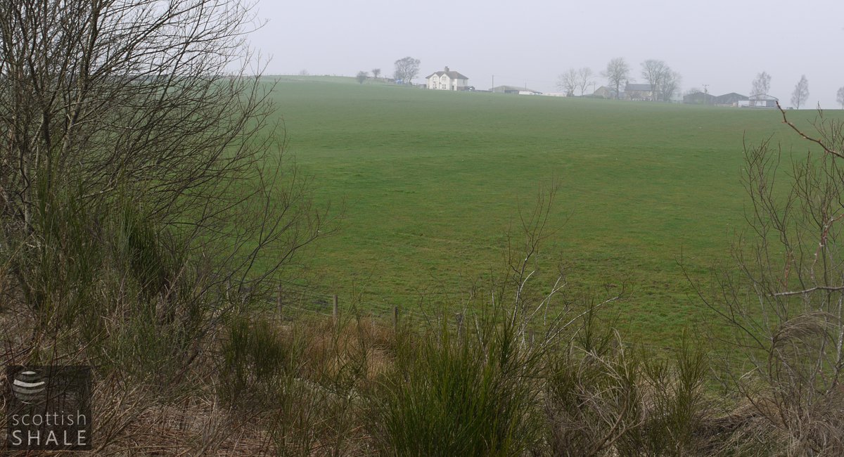
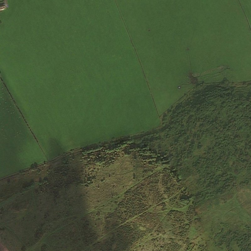
Within agricultural land, visible only in soil colouration
Regional overview:

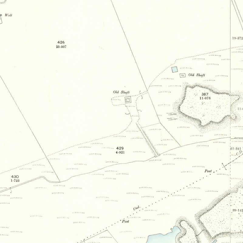
A vertical shaft, 18 fathoms deep
Serving Boghall (Starlaw) Shale Oil Works
A short-living working in the Houston Coal. It is unclear from mine plans whether this shaft also accessed the Fells Shale. Perhaps also known as Starlaw No. 2 Pit.
See "Early mines and pits in the Boghall area" for further background.
Shale-field: Cousland and Seafield shale-field.
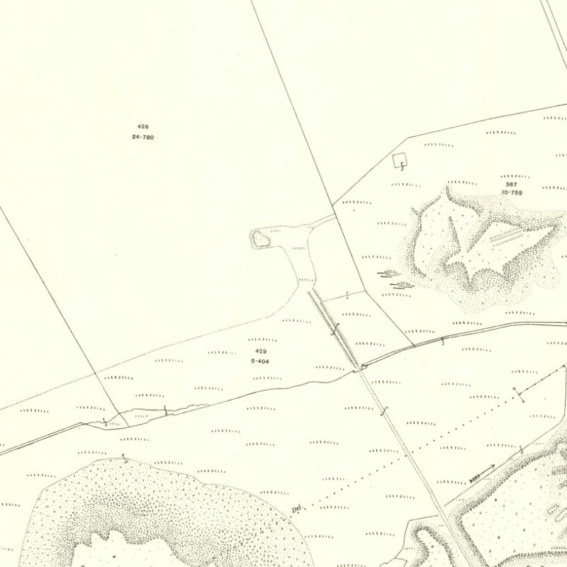
Mapped by the Ordnance Survey of c.1897, showing site of Boghall No. 2.
Recent images

View from the base of Seafield bing towards Starlaw Farm. The site of No. 2 Pit lies in the foreground. Looking north east. March 2012.
- Coal Authority Mine Abandonment Catalogue No. 164, showing workings in the Houston Coal and Fells Shale from Boghall, abandoned in 1874.
- Coal Authority Mine Abandonment Catalogue No. S2524, showing workings in the Houston Coal (1870), Dunnet (1900), under Dunnet (1900), Fells (1898) and unknown shale (1870) from Boghall, abandoned in various years.
- Coal Authority Mine Abandonment Catalogue No. 3730, showing workings in the Houston Coal (1873) and Fells Shale (1880) and Raeburn Shale (1870) from Boghall, abandoned in various years.
- Coal Authority Mine Abandonment Catalogue No. 650, showing workings in the Fells Shale from Boghall No. 4, abandoned in 1871.
The Coal Authority mine abandonment catalogue list the following shale workings from Boghall:


