- Aberdeen Oil Works
- Addiewell Oil Works
- Almondhill Oil Works
- Annick Lodge Oil Works
- Arden Oil Works
- Armadale Oil Works
- Auchenheath Oil Works
- Avonhead Oil Works
- Balgray Oil Works
- Ballat Oil Works
- Bathgate Oil Works
- Bathville Oil Works
- Bellsdyke Oil Works
- Bellsquarry Oil Works
- Benhar Oil Works
- Binnend Oil Works
- Birkenshaw Oil Works
- Bishop Street Oil Works
- Blackburn Oil Works
- Blackstone Oil Works
- Blackstoun Oil Works
- Blochairn Oil Works
- Boghall Oil Works
- Bredisholm Oil Works
- Breich Oil Works
- British Asphalte Oil Works
- Broxburn Oil Works
- Broxburn - Bell's Stewartfield Oil Works
- Broxburn - Albyn Oil Works
- Broxburn - East Mains Oil Works
- Broxburn - Greendykes Oil Works
- Broxburn - Hallfarm Oil Works
- Broxburn - Hutchinson's Oil Works
- Broxburn - Poynter's Oil Works
- Broxburn - Steele's Oil Works
- Broxburn - Steele's Stewartfield Oil Works
- Buckside Oil Works
- Burngrange Oil Works
- Calderbank Oil Works
- Canalbank Oil Works
- Champfleurie Oil Works
- Clippens Oil Works
- Cobbinshaw North Oil Works
- Cobbinshaw South Oil Works
- Coneypark Oil Works
- Craigie Oil Works
- Crown Point Oil Works
- Dalmeny Oil Works
- Deans Oil Works
- Doura Oil Works
- Drumbow Oil Works
- Drumcross Oil Works
- Drumgray Oil Works
- Dryflat Oil Works
- East Fulton Oil Works
- East Hermand Oil Works
- Eldin Oil Works
- Falkirk Oil Works
- Fergushill Oil Works
- Forthbank Oil Works
- Forth & Clyde Oil Works
- Gavieside Oil Works
- Grange Oil Works
- Grangepans Oil Works
- Greengairs Oil Works
- Hareshaw Oil Works
- Hartwood Oil Works
- Hawick Oil Works
- Hermand Oil Works (1866)
- Hermand Oil Works (1883)
- Holmes Oil Works
- Hopetoun Oil Works
- Hurlford Oil Works
- Inkerman Oil Works
- Inverkeithing Oil Works
- Kilrenny Oil Works
- Kilwinning Oil Works
- Kirkmuirhill Oil Works
- Kirkwood Oil Works
- Lanark Oil Works
- Lanemark Oil Works
- Levenseat Oil Works
- Limerigg Oil Works
- Linwood Oil Works
- Loanhead Oil Works
- Lochburn Road Oil Works
- Lochgelly Oil Works
- Longrigg Oil Works
- Magdalene Oil Works
- Methil Oil Works
- Millburn Oil Works
- Nettlehole Oil Works
- Niddry Castle Oil Works
- Nitshill Oil Works
- Oakbank Oil Works
- Palacecraig Oil Works
- Pathhead Oil Works
- Patterton Oil Works
- Pentland Oil Works
- Philpstoun Oil Works
- Port Dundas Oil Works
- Possil Oil Works
- Pumpherston Oil Works
- Raebog Oil Works
- Riggend Oil Works
- Rochsoles Oil Works
- Rochsolloch Oil Works
- Roman Camp - Almondfield Oil Works
- Roman Camp - Cawburn Oil Works
- Roman Camp Oil Works (1892)
- Roman Camp - Shale Oil Works
- Rosebank Oil Works
- Roughcraig Oil Works
- Rumford Street Oil Works
- Seafield Oil Works
- Shawsburn Oil Works
- Sheepford Locks Oil Works
- Shettleston Oil Works
- Shotts Oil Works
- Stand Oil Works
- Stanrigg Oil Works
- Stonehouse Oil Works
- Straiton Oil Works
- St. Rollox Works
- Swinehill Oil Works
- Tarbrax Oil Works
- Uphall Oil Works
- Uphall - Railway Oil Works
- Uphall - Wyllie's Oil Works
- Vulcan Chemical Works
- Wardend Oil Works
- Wattston Oil Works
- Westfield & Capeldrae Oil Works
- Westwood Oil Works (1941)
- Westwood Oil Works (1866)
- Whitebog Oil Works
- Whitehill Oil Works (Lanarkshire)
- Whitehill Oil Works (Midlothian)
- Whiterigg Oil Works
- Woodhall Oil Works
Craigie Oil Works

Redwood notes that Craigie Oil Works, Kilmarnock, operated between 1864 and 1876.
"Special Reports of the Minerals Resouces of Great Britain. Vol.XXIV, Cannel Coals", published by the Geological Survey in 1915" states "A seam known as the "Parrot" or "Sulphury Coal" forms one of the limestone coals in the Dailly basin, and parrot is also found with the Craigie seam".
It might that Craigie oil works was sited in the southern part of Ayrshire, in the vicinity of Dailly, however the Kilmarnock location indicated by Redwood suggests that the works lay considerably further to the north.
The parish of Craigie lies about five miles south of Kilmarnock, but with little coal mining in the vicinity, it seems an unlikely site for an oil works. No mention is made of oil manufacture in Craigie parish in either the 1868 or the 1872 Post Office Directory for Kilmarnock.
The 1868 (but not the 1872) directory contains one reference to coal mining in the parish: - COALMASTERS - Galloway, Lindsay & Company Adamhill Colliery. Perry's Bankrupt Gazette for February 6th 1866 lists the dissolution of the partnership between Thomas R. Lindsay, R.B. Lindsay, and William Galloway, coalmasters &c. Adamhill-colliery, KIlmarnock, due to debts by Galloway.
The Topographical Dictionary of Scotland (1846) in the entry for Tarbolton parish notes ".....cannel coal can be obtained at Adamhill, two miles from the village" (of Tarbolton). This raises the prospect that cannel coal found in this areas may have been used for oil production.
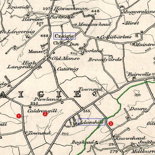
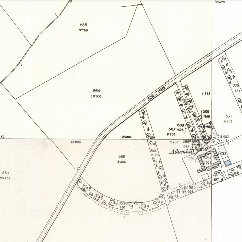
Adamhill lies a mile and quarter south of the village of Craigie, within Craigie parish, but lying close to the boundary with Tarbolton parish (marked in green). First edition OS maps (c.1857) show three areas where coal may have been mined in the vicinity of Adamhill:
- Site 1 is a tile works and clay pit, active when surveyed
- Site 2 shows two disused shafts marked as "old coal pits"
- Site 3 is close to "Scotland Bridge", just inside Tarbolton parish, is marked "coal pit" and appears active when surveyed
It seems unlikely that any of these were site of the "Adamhill Colliery" listed in the 1868 directory, however later OS maps provide no indication of subsequent coal working in this area.
The place name "Craigie" occurs in other parts of Scotland and it remains possible that Redwood has incorrectly identified the location of the works.
AYRSHIRE MINERAL FIELD TO BE LET.
The Proprietor of the Estate of Craigie is prepared to receive OFFERS for a TRIAL LEASE of the MINERALS in the ESTATE. It is known that there is a large extent of common coal in the estate and it is believed that Gas Coal and Ironstone will also be found. Craigie is about four miles South from Kilmarnock-. The Glasgow and South Western Railway is within two to three miles of the Estate. Mr John Russell, Craigie Home Farm, near Ayr will give information that may be desired regarding the boundaries of the estate.
Glasgow Herald, 28th August 1872


